Unit 4
Tech Exploration
Mapping Country
Ressource affichée de l'autre côté.
Faites défiler pour voir la suite.
Faites défiler pour voir la suite.
1Songlines and stories
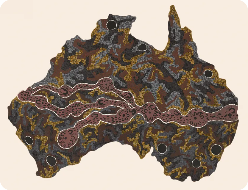
Seven Sisters Songline, Josephine Mick, 1994.
Vidéo associée
Ressource affichée de l'autre côté.
Faites défiler pour voir la suite.
Faites défiler pour voir la suite.
2Coastlines and waterways
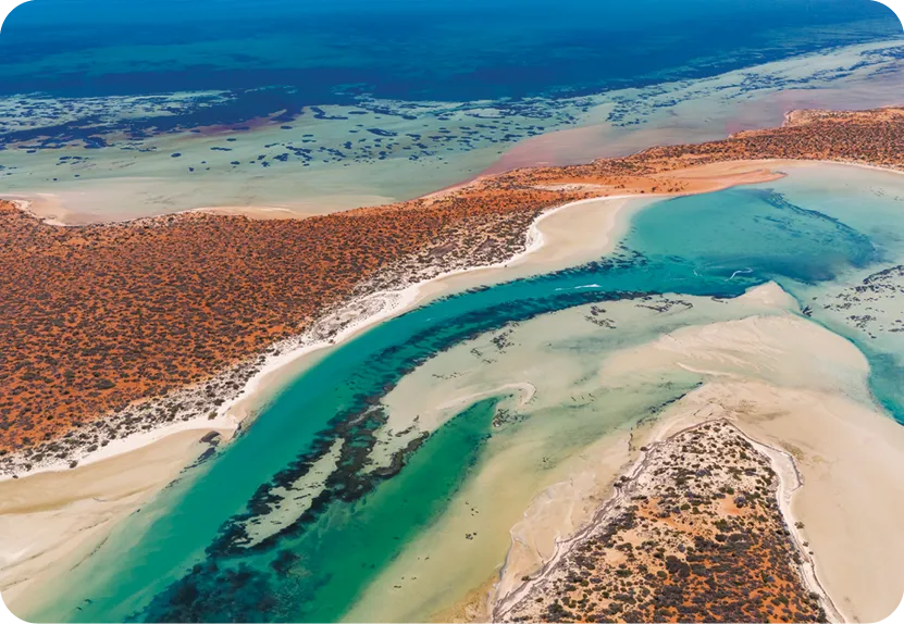
“Perspectives - Mapping our waterways”, Australian National Maritime Museum, 2023.
Vidéo associée
From 0:00 to 2:10Ressource affichée de l'autre côté.
Faites défiler pour voir la suite.
Faites défiler pour voir la suite.
3
GPS and heritage
angt-unit4-techexp-doc3.mp3
Millions of Australians will be able to request directions from Warrane (Sydney Cove) to Meanjin (Brisbane), tracing the original custodians of the land along the way, via a new feature on one of the world's leading navigational apps.
In a major collaboration with Indigenous groups, Apple Maps will now include more than 250 dual placenames for cities and towns across the country, with more to be added.
The app will also show land borders for Indigenous protected areas and reserves, and display the traditional owners of regions across the country – without marking their land boundaries.
Managing director of Indigenous consultancy company Nyikbar, Charles Prouse, worked closely with Apple to develop the project in Australia.
"We were almost wiped off the map," Prouse, a Nyikina man, said.
"To put ourselves back on the map – that's a powerful thing." [...]
"When led and governed by Indigenous communities, this work becomes more than just mapping – it is a way to honour heritage, revitalise stolen and sleeping languages, and contribute meaningfully to reconciliation," she said.
In a major collaboration with Indigenous groups, Apple Maps will now include more than 250 dual placenames for cities and towns across the country, with more to be added.
The app will also show land borders for Indigenous protected areas and reserves, and display the traditional owners of regions across the country – without marking their land boundaries.
Managing director of Indigenous consultancy company Nyikbar, Charles Prouse, worked closely with Apple to develop the project in Australia.
"We were almost wiped off the map," Prouse, a Nyikina man, said.
"To put ourselves back on the map – that's a powerful thing." [...]
"When led and governed by Indigenous communities, this work becomes more than just mapping – it is a way to honour heritage, revitalise stolen and sleeping languages, and contribute meaningfully to reconciliation," she said.
Ressource affichée de l'autre côté.
Faites défiler pour voir la suite.
Faites défiler pour voir la suite.
Communication
1-A
How do the three documents show different ways of connecting to territory in Australia?
2-A
What kinds of stories are missing from traditional (Western) maps?
3-A
Why is it important to include Indigenous names and knowledge in today's digital tools?
Ressource affichée de l'autre côté.
Faites défiler pour voir la suite.
Faites défiler pour voir la suite.
Science
1-B
What are the differences between Indigenous and Western mapping systems in terms of purpose and structure?
2-B
How does Apple's integration of Indigenous data into Maps represent a shift in digital mapping?
3-B
What challenges do new technologies face when including cultural knowledge like songlines?
Ressource affichée de l'autre côté.
Faites défiler pour voir la suite.
Faites défiler pour voir la suite.
Over to you!
Communication
Record a podcast.
Create a podcast episode exploring how different kinds of maps shape our understanding of land. Reflect on why it matters to rethink mapping in Australia today, and give specific examples of maps.
Science
Rethink the map.
Imagine a new feature for a mapping app that includes Indigenous perspectives. Sketch your idea and write a paragraph describing how it would work. Give an example using a specific place.
Une erreur sur la page ? Une idée à proposer ?
Nos manuels sont collaboratifs, n'hésitez pas à nous en faire part.
j'ai une idée !
Oups, une coquille